-
Monster blizzard takes aim at Tahoe, Mammoth - March 1, 2024
-
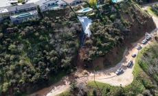
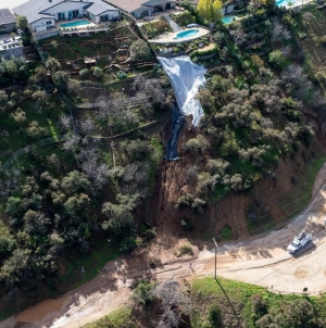
A portion of Mulholland Drive, damaged by mudslides in winter storms, reopens - May 26, 2024
-
‘Maybe You Don’t Want to Win’ - May 26, 2024
-
Donald Trump Putting Law Enforcement in Danger: Attorney - May 26, 2024
-
Avoid the waters of these 5 L.A. County beaches this holiday weekend, public health officials say - May 26, 2024
-
Bawdy Comedy ‘Anora’ Wins Palme d’Or at Cannes Film Festival - May 26, 2024
-
Map Shows Heat Wave Zone Spread Into Five New States - May 26, 2024
-
Azusa police arrest suspected slingshot-wielding vandal - May 25, 2024
-
Donald Trump Hammers Judge Ahead of Jury Instructions - May 25, 2024
-
Sometimes U.S. and U.K. Politics Seem in Lock Step. Not This Year. - May 25, 2024
Monster blizzard takes aim at Tahoe, Mammoth
A treacherous, life-threatening blizzard was targeting California’s mightiest mountain range Thursday, and forecast to hit the Lake Tahoe area by late morning and Mammoth Mountain by the afternoon.
Up to 12 feet of snow could fall on the highest peaks of the Sierra Nevada between Thursday through Sunday, the National Weather Service office in Sacramento said. Other areas with an elevation of 5,000 feet above sea level could get 5 to 10 feet of snow.
There will be “whiteout conditions with near zero-visibility at times due to blowing snow,” the weather service office in Reno warned of the strongest Sierra storm of this winter. “Do not travel. If you must travel, have a winter survival kit with you. If you get stranded, stay in your vehicle.”
Mountain travel was expected to be “extremely dangerous to impossible” beginning Thursday evening and continuing through Friday, the weather service office in Sacramento said.
And with winds expected to gust above 110 mph over the Sierra ridges, that, “combined with very heavy snowfall could cause extensive tree damage and extended power outages,” the weather service office in Sacramento said.
The main route between Southern California and Mammoth Mountain, Highway 395, could see 1 to 3 feet of snow, with gusts of up to 75 mph in these lower elevation areas.
The highest elevation of the main roads to Lake Tahoe from the San Francisco Bay Area — Interstate 80 and Highway 50 — could see up to 8 feet of snow. Interstate 5 in Siskiyou County, near the Oregon border, could see more than 1 foot of snow.
Ski resorts were thrilled with the pending dump of snowfall, but joined officials in warning that mountain roads could be closed during the worst of the storm. Ski resorts could face partial or full closures during the peak of the blizzard on Friday and Saturday.
“We do expect that Sunday will be a day of patience as we dig out,” Palisades Tahoe said on social media.
“It’s going to DUMP,” Mammoth Mountain said on social media. “It’s looking like we have a lot of digging to look forward to the next few days.”
“During these major storms expect DEEP snow, always ski and ride with a buddy, keep your buddy in sight and avoid the base of trees. Be aware of Snow Immersion Suffocation (SIS) dangers,” Mammoth Mountain added, referring to the risk when skiers leave groomed trails and fall into an area of deep, unconsolidated snow.
“If wind and snow were not enough, it will be much colder,” the National Weather Service office in Reno said. “Wind chills will drop below zero in the Sierra high country. This really does add a serious life-threatening element to this storm, and why you want to avoid getting stuck!”
Daniel Swain, a UCLA climate scientist, said he strongly encouraged people not to head up to the mountains for a powder weekend, given road travel will be dangerous. The California Highway Patrol office in Truckee has already warned about expected long delays and road closures.
Additionally, Swain wrote in a blog post, ski resorts will likely need to halt chairlifts during strong winds.
The strong storm may come as a bit of shock to the Lake Tahoe area, “given how anemic this year’s snow season has been thus far at lake level,” Swain wrote in a blog post. “But this one looks like the real deal. … This is virtually guaranteed to be a dangerous and disruptive snowstorm.”
The National Weather Service issued a blizzard warning over a wide swath of the Sierra Nevada, from Lassen Volcanic National Park in Shasta County to Kings Canyon National Park in Fresno County. The blizzard warning began on Thursday and lasts through Sunday; the worst of the storm was expected between Friday afternoon through the midday of Saturday.
“For Sierra locations, don’t get caught up in the ‘worst conditions’ timeframe. It is going to be really bad throughout the entire event!” the weather service office in Reno warned. “Winds … will remain strong enough to produce near-zero visibility in the Sierra and the foothills.”
The weather service office in Eureka warned of snow on all roads 1,000 feet above sea level between Thursday through Saturday.
Highway 101 at Ridgewood Summit in Mendocino County could get half a foot of snow. And Highway 101 at Prairie Creek Summit in Humboldt County could get 1 to 1.5 feet of snow.
Hail could strike coastal roads in Humboldt and Del Norte counties on Friday and Saturday, and linger, forecasters said. “Ease off the gas if you suddenly find yourself on a hail-covered roadway,” the weather service said. “Do not slam on the brakes. Avoid overcorrecting.”
At Yosemite National Park, this blizzard is expected to be similar to one that hit Dec. 21, 2021, when more than 6 feet of snow fell at Tuolumne Meadows along Tioga Road. “However, there will be more wind with this storm,” the weather service office in Hanford said. A blizzard warning was in effect for Yosemite National Park outside of Yosemite Valley starting Thursday afternoon; a winter storm warning was issued for Yosemite Valley between Saturday morning to Sunday morning.
There’s a chance of up to 1 inch of snow on the Grapevine section of Interstate 5, which connects Los Angeles County with the Central Valley through the Tejon Pass. Snow is also possible on Highway 58 over the Tehachapi Pass, which connects Bakersfield with the Mojave Desert.
In the mountains of San Diego, Riverside and San Bernardino counties, there could be 3 to 7 inches of snow at areas 7,000 feet above sea level, and 1 to 3 inches at areas between 6,000 to 7,000 feet.
In Los Angeles County, areas at 7,000 feet above sea level could see 5 to 10 inches of snow, and areas 4,000 above sea level could see at least 1 inch of snow.
There’s a slight chance of rain in L.A., Orange and Ventura counties during the day Friday, a probability that grows on Friday night. Rain is expected during the day Saturday in those coastal counties as well as the Inland Empire.
From Friday through Sunday, downtown L.A. is expected to get 0.41 inches of rain; Long Beach, 0.34 inches; Redondo Beach, 0.29 inches; Santa Clarita, 0.51 inches; Pomona, 0.58 inches; Oxnard, 0.34 inches; and Santa Barbara, 0.48 inches.
Anaheim could get up to half an inch of rain; Irvine, San Clemente and Riverside, up to 0.4 inches; Ontario, up to 0.7 inches; San Bernardino, up to 1 inch; and San Diego, up to 0.2 inches.
The San Francisco Bay Area is forecast to see rain and winds Thursday through Saturday, with 0.5 to 2 inches of precipitation expected in the cities. Snow is possible on the Bay Area’s highest peaks.
Strong gusts of between 35 to 55 mph are a concern in the section of the Sacramento Valley that is north of Marysville, the county seat of Yuba County.
Source link


